Shop
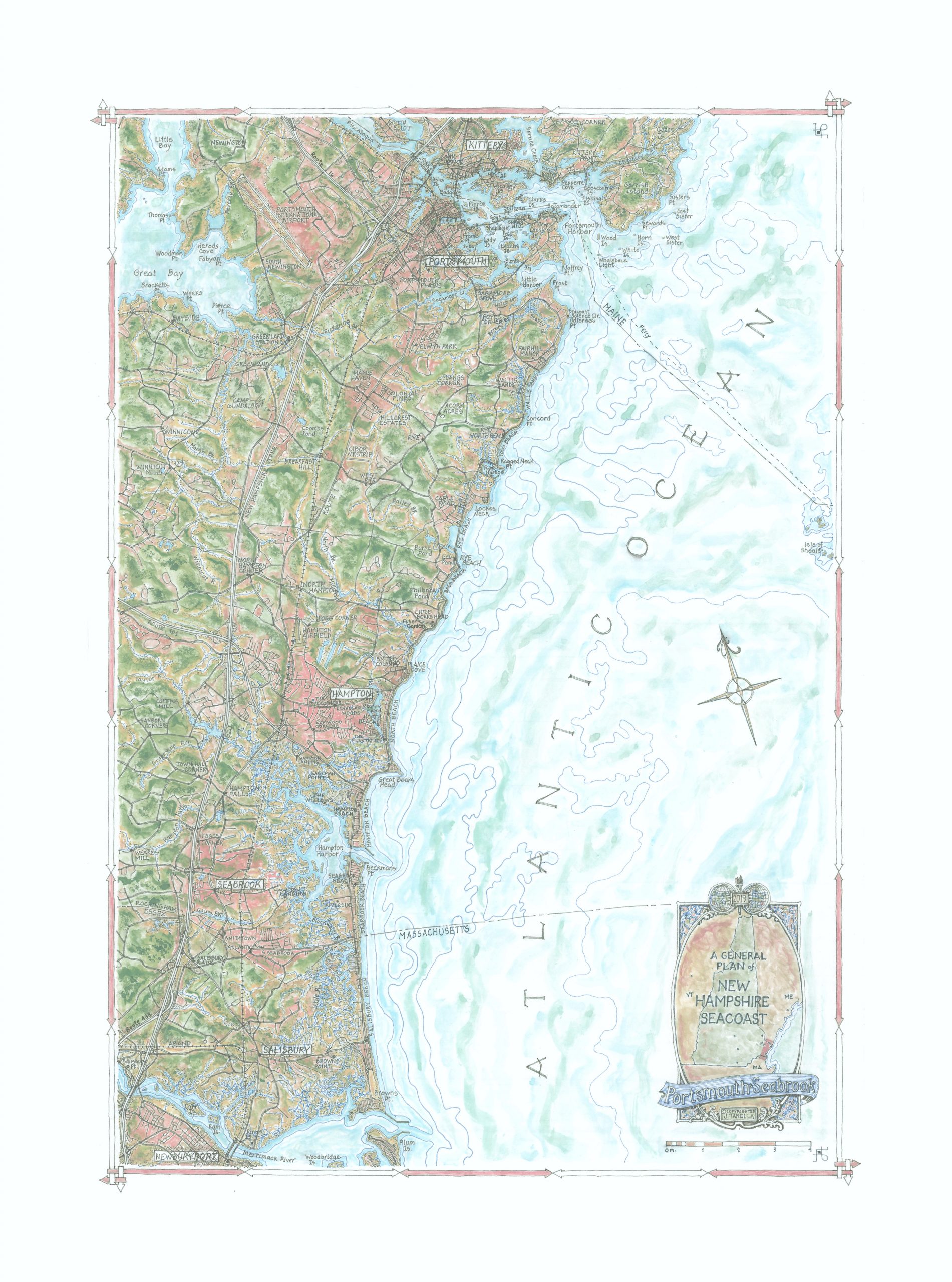
A General Plan of the New Hampshire Seacoast—Portsmouth to Seabrook
$150.00
Our most northerly map of the continental US to date, this depicts a small strip of land that represents the entire Atlantic Seacoast of New Hampshire, a 16 mile stretch from the northern border of Massachusetts to the southern tip of Maine. This charming, diverse and historic wedge of classic New England landscape, replete with dramatic headlands, stunning beaches and classic harbor towns and boating havens, showcases exactly what one would expect. The historic landing port and resort of Portsmouth, at the northernmost point, still revolves around the harbor and the many available water excursions. Further down the coast is Odiorne Point State Park, Fuller Botanical Gardens, Hampton Beach and, around 7 miles off shore, the Isle of Shoals. The whole area provides an unexpected and delightful mapping find.
39S. 18×25″